

.CXTF Extensão de arquivo
Arquivo Coordinates Exchange Text-Format
| Desenvolvedor | Stefan Gies |
| Popularidade |
2,0 | 1 Voto |
O que é um arquivo CXTF?
Um arquivo CXTF é um arquivo de gráficos vetoriais salvo no formato Coordinates Exchange Text-Format (CXTF). Ele armazena desenhos baseados em coordenadas compostos por pontos, linhas, polígonos, curvas, texto, símbolos, camadas, cores e outros objetos. Os arquivos CXTF normalmente representam mapas, desenhos técnicos ou gráficos científicos e são salvos em um formato de texto simples, o que facilita a leitura e o processamento dos dados por aplicativos compatíveis e desenvolvedores.
Mais informações
Stefan Gies desenvolveu o CXTF como um formato aberto e independente de plataforma para compartilhar gráficos vetoriais, mantendo os dados fáceis de ler e editar. Cartógrafos, profissionais de SIG, engenheiros, cientistas e desenvolvedores de software podem usar arquivos CXTF para trocar gráficos baseados em coordenadas entre ferramentas compatíveis.
Ao contrário de muitos formatos vetoriais que armazenam dados em formato binário, o CXTF usa uma sintaxe de texto estruturada, com um comando por linha. Essa abordagem permite que os desenvolvedores processem arquivos de forma programática, acompanhem alterações em sistemas de controle de versão e inspecionem ou modifiquem o conteúdo com um editor de texto quando necessário.
O CXTF organiza objetos gráficos em uma estrutura hierárquica compatível com grupos, camadas e elementos compartilhados. O formato é compatível com dados de coordenadas 2D e 3D, além de informações de estilo, como cores, gradientes, estilos de linha e formatação de texto. Recursos externos, como imagens, podem ser referenciados por um arquivo CXTF ou empacotados juntos em um arquivo .CXZIP complementar para facilitar a distribuição.
Como abrir um arquivo CXTF
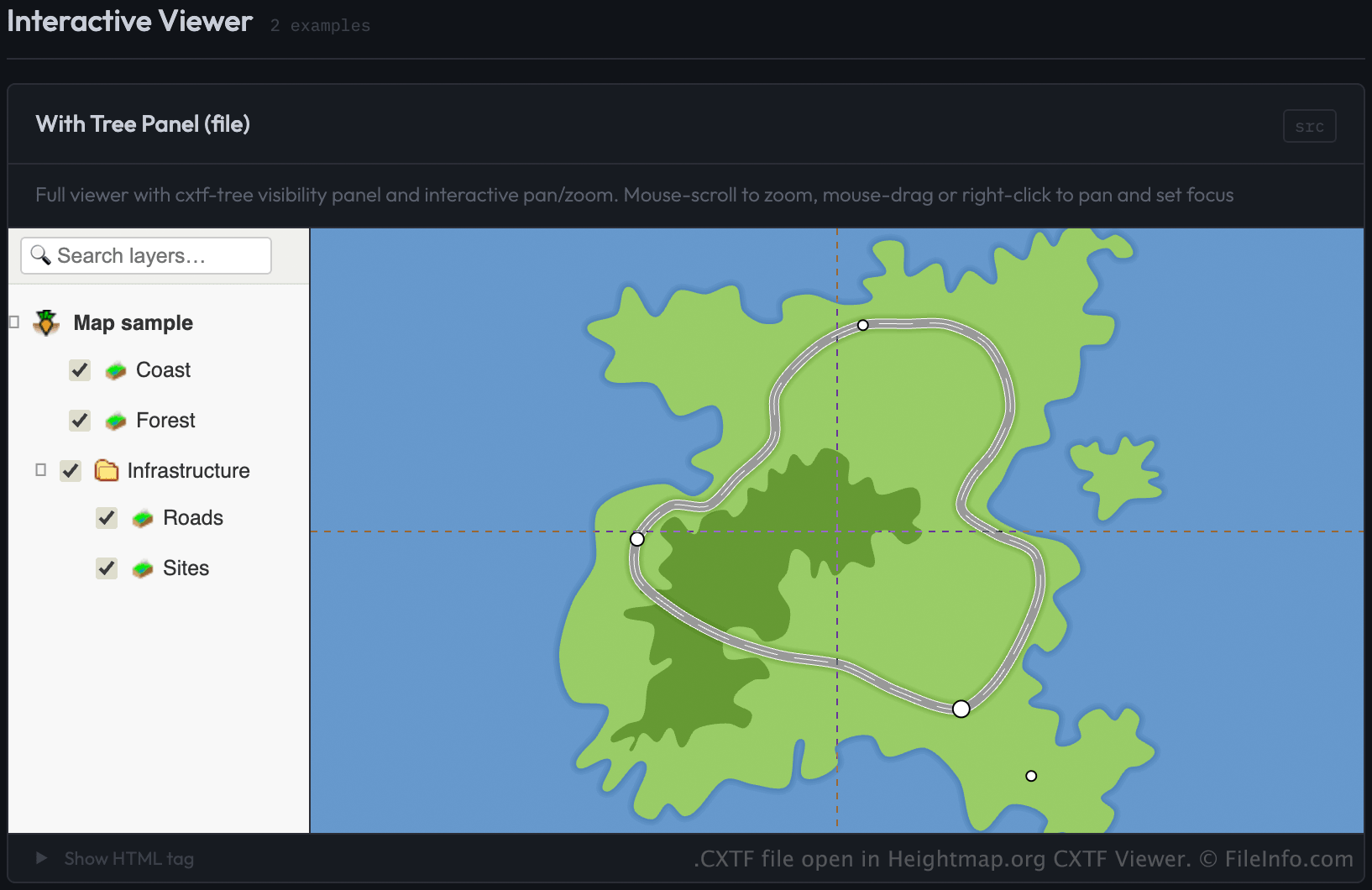
Você pode abrir arquivos CXTF com o CXTF Viewer da Heightmap.org carregando o arquivo em uma página da web que use o componente do visualizador CXTF. O visualizador exibe os gráficos baseados em coordenadas em um navegador da web.
Os desenvolvedores podem carregar arquivos CXTF no visualizador especificando o arquivo como a origem (src) de um elemento <cxtf-view> em uma página da web. Por exemplo:
<cxtf-view src="examples/map.cxtf"
            width="720"
            height="360"
            centered="true"
            interactive="true"></cxtf-view>
Como os arquivos CXTF são salvos como texto simples, você também pode visualizar o conteúdo com um editor de texto, embora seja necessário um visualizador compatível com CXTF para exibir os gráficos corretamente.