

.CXTF Extensión de archivo
Archivo de formato de texto de intercambio de coordenadas
| Desarrollador | Stefan Gies |
| Popularidad |
2,0 | 1 Voto |
¿Qué es un archivo CXTF?
Un archivo CXTF es un archivo de gráficos vectoriales guardado en el formato de texto de intercambio de coordenadas (CXTF). Almacena dibujos basados en coordenadas compuestos por puntos, líneas, polígonos, curvas, texto, símbolos, capas, colores y otros objetos. Los archivos CXTF suelen representar mapas, dibujos técnicos o gráficos científicos, y se guardan en un formato de texto sin formato, lo que facilita que las aplicaciones compatibles y los desarrolladores lean y procesen los datos.
Más información
Stefan Gies desarrolló CXTF como un formato abierto e independiente de la plataforma para compartir gráficos vectoriales y mantener los datos fáciles de leer y editar. Los cartógrafos, profesionales de los SIG, ingenieros, científicos y desarrolladores de software pueden usar archivos CXTF para intercambiar gráficos basados en coordenadas entre herramientas compatibles.
A diferencia de muchos formatos vectoriales que almacenan los datos en formato binario, CXTF usa una sintaxis de texto estructurada con un comando por línea. Este método permite a los desarrolladores procesar los archivos mediante programación, realizar un seguimiento de los cambios en sistemas de control de versiones e inspeccionar o modificar su contenido con un editor de texto cuando sea necesario.
CXTF organiza los objetos gráficos en una estructura jerárquica compatible con grupos, capas y elementos compartidos. El formato admite datos de coordenadas 2D y 3D, además de información de estilo, como colores, degradados, estilos de línea y formato de texto. Los recursos externos, como las imágenes, pueden referenciarse desde un archivo CXTF o empaquetarse junto con él en un archivo .CXZIP complementario para facilitar su distribución.
Cómo abrir un archivo CXTF
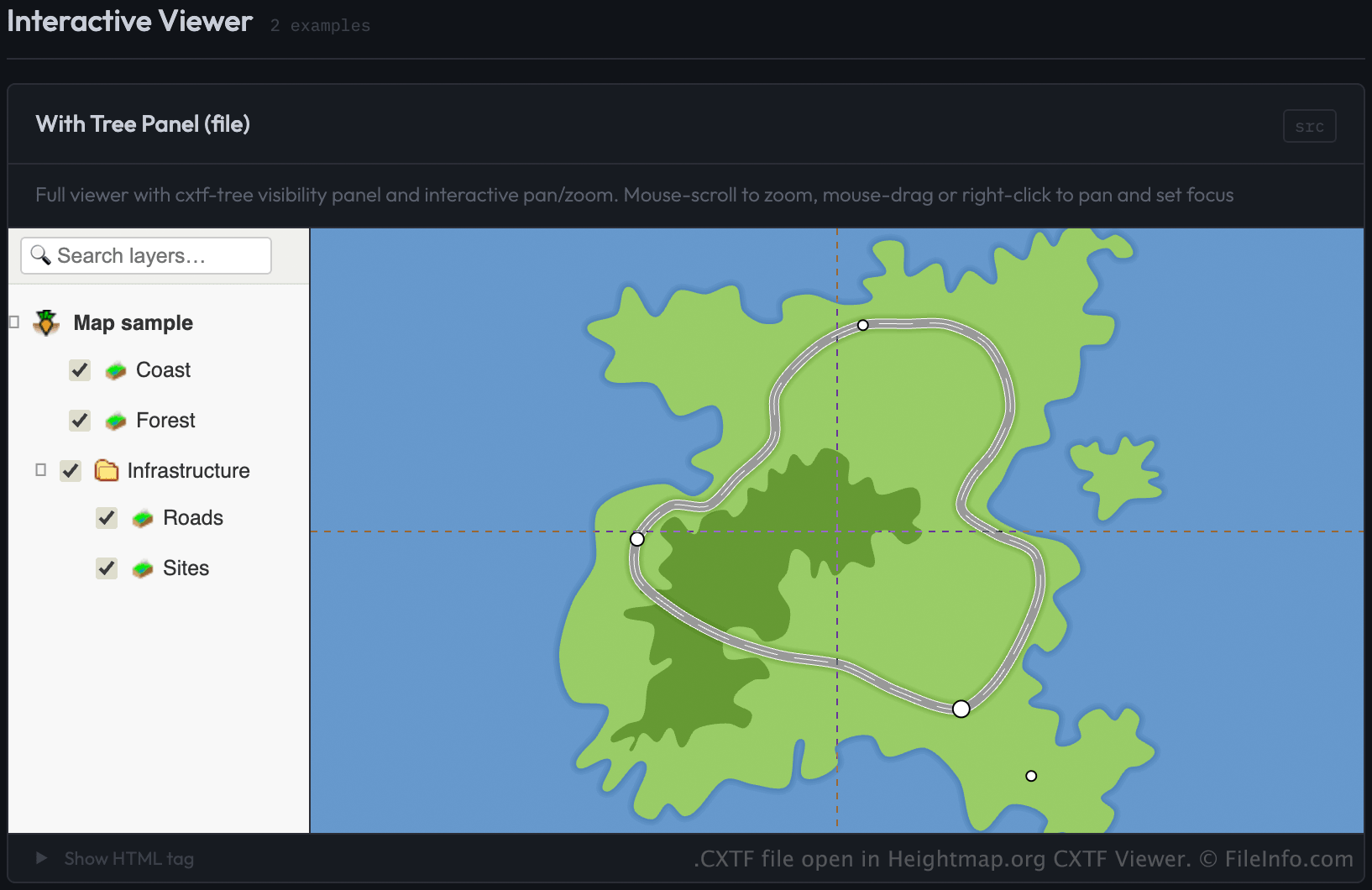
Puede abrir archivos CXTF con CXTF Viewer de Heightmap.org cargando el archivo mediante una página web que use el componente de visor CXTF. El visor muestra los gráficos basados en coordenadas en un navegador web.
Los desarrolladores pueden cargar archivos CXTF en el visor especificando el archivo como origen (src) de un elemento <cxtf-view> en una página web. Por ejemplo:
<cxtf-view src="examples/map.cxtf"
            width="720"
            height="360"
            centered="true"
            interactive="true"></cxtf-view>
Como los archivos CXTF se guardan como texto sin formato, también puede ver su contenido con un editor de texto, aunque se necesita un visor compatible con CXTF para mostrar los gráficos correctamente.