

.CXTF Bestandsextensie
Coordinates Exchange Text-Format-bestand
| Ontwikkelaar | Stefan Gies |
| Populariteit |
2,0 | 1 stem |
Wat is een CXTF-bestand?
Een CXTF-bestand is een bestand met vectorafbeeldingen dat is opgeslagen in de Coordinates Exchange Text-Format (CXTF). Het bevat tekeningen op basis van coördinaten die bestaan uit punten, lijnen, polygonen, krommen, tekst, symbolen, lagen, kleuren en andere objecten. CXTF-bestanden stellen meestal kaarten, technische tekeningen of wetenschappelijke afbeeldingen voor en worden opgeslagen in een indeling met platte tekst, waardoor compatibele toepassingen en ontwikkelaars de gegevens gemakkelijk kunnen lezen en verwerken.
Meer informatie
Stefan Gies ontwikkelde CXTF als een open, platformonafhankelijke indeling voor het delen van vectorafbeeldingen, waarbij de gegevens gemakkelijk leesbaar en bewerkbaar blijven. Cartografen, GIS-professionals, ingenieurs, wetenschappers en softwareontwikkelaars kunnen CXTF-bestanden gebruiken om afbeeldingen op basis van coördinaten uit te wisselen tussen compatibele programma's.
In tegenstelling tot veel vectorindelingen die gegevens in binaire vorm opslaan, gebruikt CXTF een gestructureerde tekstsyntaxis met één opdracht per regel. Hierdoor kunnen ontwikkelaars bestanden programmatisch verwerken, wijzigingen bijhouden in versiebeheersystemen en de inhoud ervan indien nodig met een teksteditor bekijken of aanpassen.
CXTF ordent grafische objecten in een hiërarchische structuur die groepen, lagen en gedeelde elementen ondersteunt. De indeling ondersteunt zowel 2D- als 3D-coördinatengegevens, evenals opmaakgegevens zoals kleuren, kleurverlopen, lijnstijlen en tekstopmaak. Externe bronnen, zoals afbeeldingen, kunnen vanuit een CXTF-bestand worden verwezen of samen met het bestand worden verpakt in een bijbehorend .CXZIP-archief, zodat ze gemakkelijker kunnen worden verspreid.
Een CXTF-bestand openen
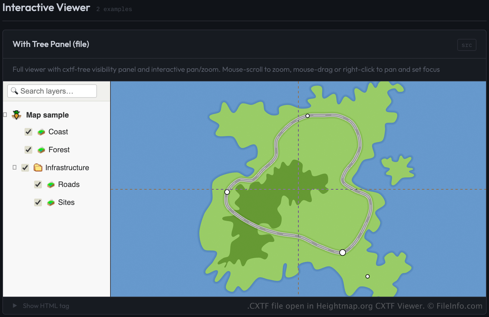
Je kunt CXTF-bestanden openen met CXTF Viewer van Heightmap.org door het bestand te laden via een webpagina die de CXTF-viewercomponent gebruikt. De viewer toont de afbeeldingen op basis van coördinaten in een webbrowser.
Ontwikkelaars kunnen CXTF-bestanden in de viewer laden door het bestand op te geven als de bron (src) van een <cxtf-view>-element in een webpagina. Bijvoorbeeld:
<cxtf-view src="examples/map.cxtf"
            width="720"
            height="360"
            centered="true"
            interactive="true"></cxtf-view>
Omdat CXTF-bestanden als platte tekst worden opgeslagen, kun je de inhoud ook met een teksteditor bekijken. Om de afbeeldingen correct weer te geven, heb je echter een CXTF-compatibele viewer nodig.