

.CXTF Estensione file
File del formato Coordinates Exchange Text-Format
| Sviluppatore | Stefan Gies |
| Popolarità |
2,0 | 1 Voto |
Che cos'è un file CXTF?
Un file CXTF è un file di grafica vettoriale salvato nel formato Coordinates Exchange Text-Format (CXTF). Memorizza disegni basati su coordinate composti da punti, linee, poligoni, curve, testo, simboli, livelli, colori e altri oggetti. I file CXTF rappresentano in genere mappe, disegni tecnici o grafici scientifici e vengono salvati in formato di testo semplice, rendendo i dati facili da leggere ed elaborare per le applicazioni compatibili e gli sviluppatori.
Maggiori informazioni
Stefan Gies ha sviluppato CXTF come formato aperto e indipendente dalla piattaforma per condividere grafica vettoriale mantenendo i dati facili da leggere e modificare. Cartografi, professionisti GIS, ingegneri, scienziati e sviluppatori di software possono usare i file CXTF per scambiare grafica basata su coordinate tra strumenti compatibili.
A differenza di molti formati vettoriali che memorizzano i dati in forma binaria, CXTF usa una sintassi testuale strutturata con un comando per riga. Questo approccio consente agli sviluppatori di elaborare i file tramite programmi, tenere traccia delle modifiche nei sistemi di controllo versione e controllarne o modificarne i contenuti con un editor di testo quando necessario.
CXTF organizza gli oggetti grafici in una struttura gerarchica che supporta gruppi, livelli ed elementi condivisi. Il formato supporta dati di coordinate 2D e 3D, oltre a informazioni sullo stile come colori, sfumature, stili delle linee e formattazione del testo. Le risorse esterne, come le immagini, possono essere referenziate da un file CXTF o incluse insieme al file in un archivio .CXZIP associato per facilitarne la distribuzione.
Come aprire un file CXTF
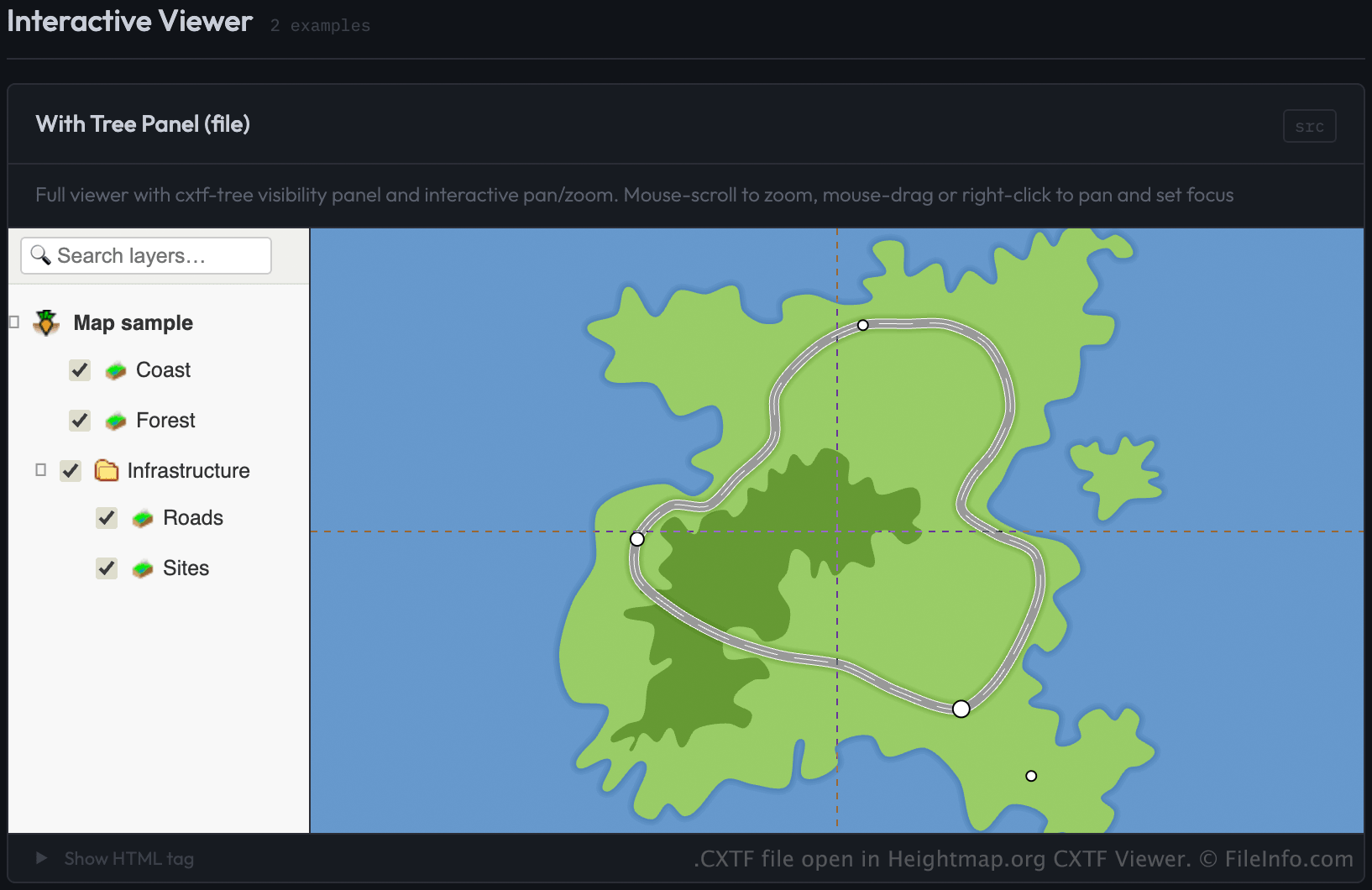
Puoi aprire i file CXTF con CXTF Viewer di Heightmap.org caricando il file tramite una pagina web che usa il componente visualizzatore CXTF. Il visualizzatore mostra la grafica basata su coordinate in un browser web.
Gli sviluppatori possono caricare i file CXTF nel visualizzatore specificando il file come origine (src) di un elemento <cxtf-view> in una pagina web. Ad esempio:
<cxtf-view src="examples/map.cxtf"
            width="720"
            height="360"
            centered="true"
            interactive="true"></cxtf-view>
Poiché i file CXTF vengono salvati come testo semplice, puoi anche visualizzarne i contenuti con un editor di testo, anche se per visualizzare correttamente la grafica è necessario un visualizzatore compatibile con CXTF.