

.CXTF Přípona souboru
Soubor ve formátu Coordinates Exchange Text-Format
| Vývojář | Stefan Gies |
| Popularita |
2,0 | 1 hlas |
Co je soubor CXTF?
Soubor CXTF je soubor vektorové grafiky uložený ve formátu Coordinates Exchange Text-Format (CXTF). Ukládá kresby založené na souřadnicích, které se skládají z bodů, čar, polygonů, křivek, textu, symbolů, vrstev, barev a dalších objektů. Soubory CXTF obvykle představují mapy, technické výkresy nebo vědeckou grafiku a ukládají se v prostém textovém formátu, takže kompatibilní aplikace a vývojáři mohou data snadno číst a zpracovávat.
Další informace
Stefan Gies vyvinul CXTF jako otevřený formát nezávislý na platformě pro sdílení vektorové grafiky, přičemž data zůstávají snadno čitelná a upravitelná. Kartografové, odborníci na GIS, inženýři, vědci a vývojáři softwaru mohou soubory CXTF používat k výměně grafiky založené na souřadnicích mezi kompatibilními nástroji.
Na rozdíl od mnoha vektorových formátů, které ukládají data v binární podobě, používá CXTF strukturovanou textovou syntaxi s jedním příkazem na řádek. Tento přístup umožňuje vývojářům zpracovávat soubory programově, sledovat změny v systémech pro správu verzí a podle potřeby kontrolovat nebo upravovat jejich obsah v textovém editoru.
CXTF organizuje grafické objekty do hierarchické struktury, která podporuje skupiny, vrstvy a sdílené prvky. Formát podporuje 2D i 3D souřadnicová data spolu s informacemi o stylu, jako jsou barvy, přechody, styly čar a formátování textu. Na externí zdroje, například obrázky, lze odkazovat ze souboru CXTF nebo je lze pro snadnější distribuci zabalit do doprovodného archivu .CXZIP.
Jak otevřít soubor CXTF
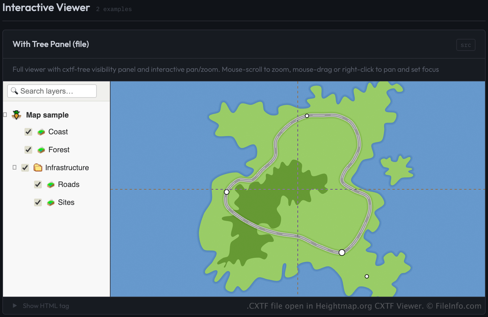
Soubory CXTF můžete otevřít v programu CXTF Viewer od Heightmap.org tak, že soubor načtete prostřednictvím webové stránky, která používá komponentu prohlížeče CXTF. Prohlížeč zobrazuje grafiku založenou na souřadnicích ve webovém prohlížeči.
Vývojáři mohou soubory CXTF načíst v prohlížeči tak, že soubor nastaví jako zdroj (src) prvku <cxtf-view> na webové stránce. Například:
<cxtf-view src="examples/map.cxtf"
            width="720"
            height="360"
            centered="true"
            interactive="true"></cxtf-view>
Protože se soubory CXTF ukládají jako prostý text, můžete jejich obsah zobrazit také v textovém editoru, ale ke správnému zobrazení grafiky je zapotřebí prohlížeč kompatibilní s CXTF.