

.KML 파일 확장자
Keyhole Markup Language 파일
| 개발사 | |
| 인기도 |
3.7 | 263 표 |
KML 파일이란 무엇인가요?
KML 파일은 지리 정보 시스템(GIS) 데이터 형식인 XML 기반의 지리 정보 형식인 Keyhole Markup Language(KML)로 지리 모델링 정보를 저장합니다. 여기에는 위치 표시, 지점, 선, 다각형, 이미지가 포함됩니다. KML 파일은 위치를 식별하고 표시하며, 다양한 카메라 각도를 만들고, 텍스처를 오버레이하고, HTML 콘텐츠(링크, 글꼴 스타일 등)를 추가하는 데 사용됩니다.
추가 정보
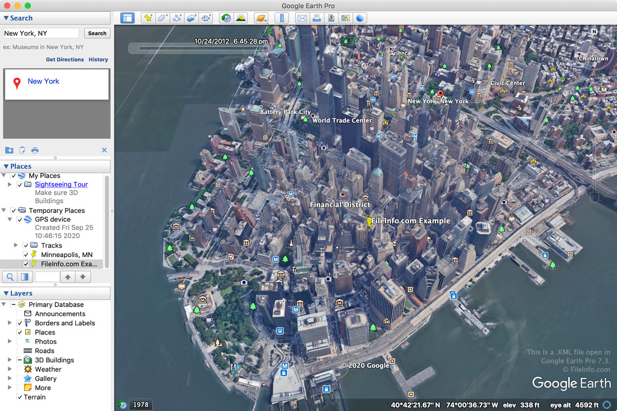
KML 형식은 원래 Keyhole, Inc.가 매핑 프로그램인 Keyhole Earth Viewer용으로 개발했습니다. Keyhole Earth Viewer는 2004년에 Google이 인수했습니다. 이 형식은 결국 2D 및 3D 지리 매핑 프로그램에서 지리적 주석과 시각화를 위한 전 세계 표준이 되었습니다.
KML 파일은 주로 Google Earth 웹 애플리케이션 및 Google Earth Pro 데스크톱 프로그램과 연결됩니다. 또한 Blue Marble Geographics Global Mapper 및 ESRI ArcGIS Pro와 같은 다른 매핑 애플리케이션에서도 지원됩니다.
대부분의 KML 파일은 Google Earth 또는 Google Earth Pro로 생성됩니다. Google Earth에서 KML 파일을 만들려면 왼쪽 창에서 "Projects" 아이콘을 클릭하고 "Create"를 선택한 다음 "Create KML file"을 선택합니다. Google Earth Pro에서 KML 파일을 만들려면 를 선택한 다음 드롭다운 메뉴에서 "Kml"을 선택합니다.
KML 파일은 일반 텍스트로 저장되므로 사용자는 처음부터 KML 파일을 만들거나 Google Earth Pro에서 기능을 복사해 만들 수 있습니다. 이렇게 하려면 Google Earth Pro의 3D Viewer에서 기능을 마우스 오른쪽 버튼으로 클릭하고 를 선택한 다음 텍스트 편집기에서 연 TXT 파일에 붙여넣습니다. 그런 다음 .TXT 파일을 저장하고 .txt 파일 확장자를 .kml로 변경할 수 있습니다.
참고: 사용자는 KML 파일을 .KMZ 파일로 저장할 수도 있습니다. KMZ 파일은 다른 사용자와 파일을 공유할 때 공간을 절약하도록 Zip으로 압축됩니다.
KML 파일을 여는 방법
Windows, macOS, Linux, Android, iOS용 다양한 매핑 애플리케이션으로 KML 파일을 열 수 있습니다. Google Earth 웹 브라우저 애플리케이션과 Google Earth Pro 데스크톱 애플리케이션이 일반적으로 사용됩니다.
Google Earth에서 KML 파일을 열려면 왼쪽 창에서 "Projects" 아이콘을 클릭하고 "Open"을 선택한 다음 "Import KML file from Google Drive" 또는 "Import KML file from computer"를 선택합니다. Google Earth Pro에서 KML 파일을 열려면 을 선택합니다.
KML 파일은 일반 텍스트의 XML과 유사한 형식으로 저장되므로 Microsoft Notepad(Windows) 또는 Apple TextEdit(macOS)와 같은 텍스트 편집기로 열 수 있습니다.
참고: 온라인 위치에 KML 파일을 호스팅한 다음 Google Maps 검색창에 URL을 입력하여 Google Maps에서 KML 파일을 열 수도 있습니다. 예를 들어 KML 파일을 http://mywebsite.com/myfile.kml에 호스팅한 경우 Google Maps 검색창에 이 URL을 입력하면 파일이 표시됩니다.
또는 KML 파일의 URL 앞에 http://maps.google.com/maps?q=를 붙여 Google Maps에서 직접 URL을 구성할 수 있습니다. 위와 동일한 KML 파일을 열려면 다음 URL을 사용할 수 있습니다.
http://maps.google.com/maps?q=http://mywebsite.com/myfile.kml
이 절차는 Google Earth View에서도 작동합니다. Google Earth View는 웹 브라우저에 추가할 수 있는 3D 지구 탐색 플러그인입니다.