

.KML Rozszerzenie pliku
Plik Keyhole Markup Language
| Deweloper | |
| Popularność |
3,7 | 263 Głosy |
Czym jest plik KML?
Plik KML przechowuje informacje o modelowaniu geograficznym w języku Keyhole Markup Language (KML), który jest formatem danych systemów informacji geograficznej (GIS) opartym na XML. Zawiera oznaczenia miejsc, punkty, linie, wielokąty i obrazy. Pliki KML służą do identyfikowania i oznaczania lokalizacji, tworzenia różnych kątów widoku, nakładania tekstur oraz dodawania treści HTML (łączy, stylów czcionek itp.).
Więcej informacji
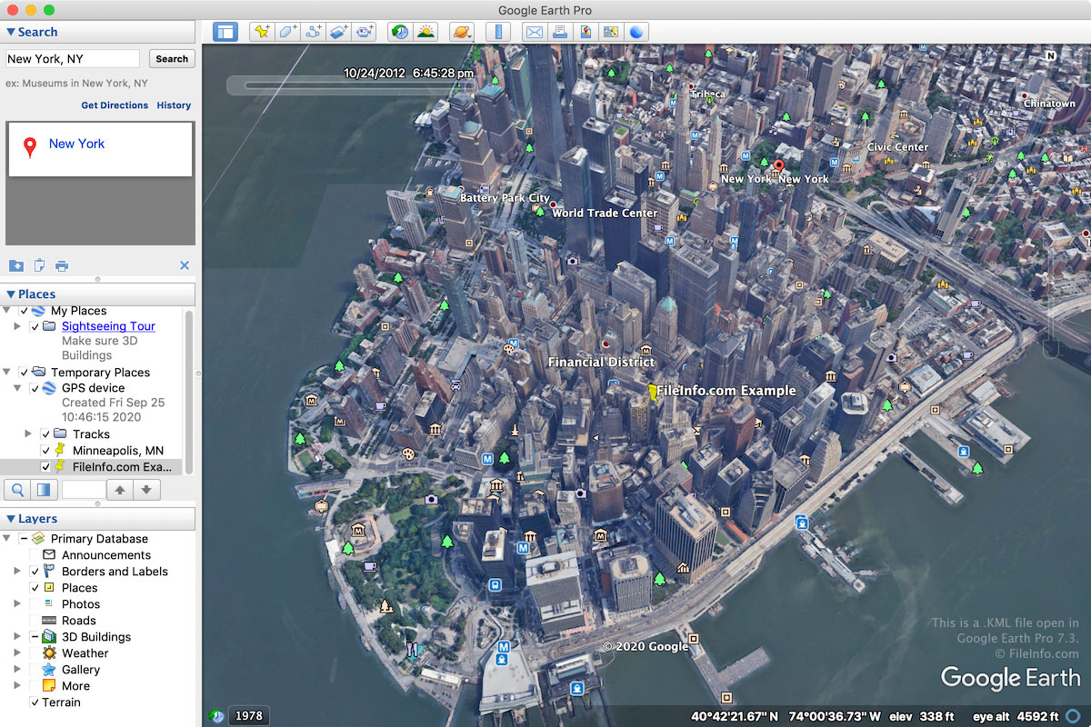
Format KML został pierwotnie opracowany przez firmę Keyhole, Inc. dla programu Keyhole Earth Viewer, czyli programu do tworzenia map, który w 2004 roku został przejęty przez Google. Format ten ostatecznie stał się światowym standardem adnotacji geograficznych i wizualizacji w programach do tworzenia map geograficznych 2D i 3D.
Pliki KML są przede wszystkim kojarzone z aplikacją internetową Google Earth oraz komputerowym programem Google Earth Pro. Są również obsługiwane przez inne aplikacje do tworzenia map, takie jak Blue Marble Geographics Global Mapper i ESRI ArcGIS Pro.
Większość plików KML jest tworzona za pomocą Google Earth lub Google Earth Pro. Aby utworzyć plik KML w Google Earth, kliknij ikonę „Projects” w lewym panelu, wybierz „Create”, a następnie „Create KML file”. Aby utworzyć plik KML w Google Earth Pro, wybierz , a następnie wybierz „Kml” z menu rozwijanego.
Ponieważ pliki KML są zapisywane jako zwykły tekst, użytkownicy mogą tworzyć pliki KML od podstaw lub kopiować elementy z Google Earth Pro. Aby to zrobić, kliknij prawym przyciskiem myszy element w module 3D Viewer programu Google Earth Pro i wybierz , a następnie wklej go do pliku TXT otwartego w edytorze tekstu. Następnie użytkownicy mogą zapisać pliki .TXT i zmienić rozszerzenie pliku .txt na .kml.
UWAGA: Użytkownicy mogą zapisywać pliki KML jako pliki .KMZ, które są kompresowane za pomocą formatu Zip, aby zajmowały mniej miejsca podczas udostępniania ich innym użytkownikom.
Jak otworzyć plik KML
Pliki KML można otwierać za pomocą różnych aplikacji do tworzenia map dla systemów Windows, macOS, Linux, Android i iOS. Często wybierane są aplikacja internetowa Google Earth oraz komputerowa aplikacja Google Earth Pro.
Aby otworzyć plik KML w Google Earth, kliknij ikonę „Projects” w lewym panelu, wybierz „Open”, a następnie „Import KML file from Google Drive” lub „Import KML file from computer”. Aby otworzyć plik KML w Google Earth Pro, wybierz .
Ponieważ pliki KML są zapisywane w formacie zwykłego tekstu podobnym do XML, można je otwierać za pomocą edytora tekstu, takiego jak Microsoft Notepad (Windows) lub Apple TextEdit (macOS).
UWAGA: Plik KML można również otworzyć w Mapach Google, umieszczając go w lokalizacji online, a następnie wpisując URL w polu wyszukiwania Map Google. Na przykład jeśli umieścisz plik KML pod adresem http://mywebsite.com/myfile.kml, wpisz ten URL w polu wyszukiwania Map Google, aby go wyświetlić.
Możesz również samodzielnie utworzyć URL w Mapach Google, poprzedzając URL pliku KML ciągiem http://maps.google.com/maps?q=. Na przykład aby otworzyć ten sam plik KML, o którym mowa powyżej, możesz użyć następującego adresu URL:
http://maps.google.com/maps?q=http://mywebsite.com/myfile.kml
Ta procedura działa również w Google Earth View, czyli wtyczce do przeglądania Ziemi w 3D, którą można dodać do przeglądarki internetowej.