.RST ファイル拡張子

2個のファイルタイプ.rst拡張子を使用しています。

reStructuredText File

開発元 David Goodger
人気度
3.6  |  39 
 

RSTファイルとは?

An RST file is a text file that contains code written in the reStructuredText markup language. reStructuredText is used to apply basic styles and formatting to plain text documents. RST files most commonly contain technical documentation for Python programs, though they may also contain text that is meant to be converted into an eBook, simple webpage, or other document.

詳細情報

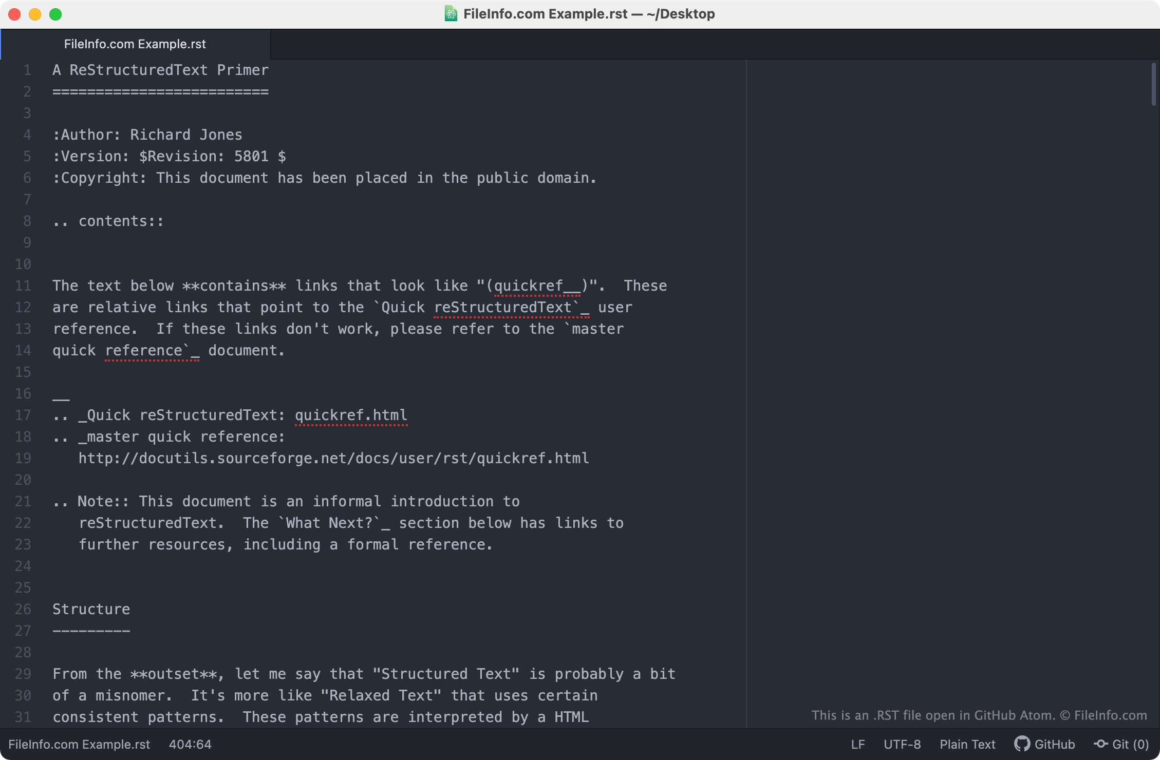
GitHub Atomで開いた.rstファイルのスクリーンショット
GitHub Atomで開いたRSTファイル

reStructuredText is a file format and markup language that software developers and technical writers use to produce technical documentation for Python-based software programs. When processed using the Python Docutils tool or another documentation-processing program, the markup symbols that reStructuredText (RST) files contain are transformed into text formatting.

For example, to add a bulleted list to an RST file, an author would write the following:

- Bulleted list item

When processed by a documentation-processing program, the above text would be shown as:

  • Bulleted list item
  • Bulleted list item
  • Bulleted list item

RST files can also contain symbols used to indicate that text should be bolded (** **), italicized (* *), or transformed into a section header (=====) or sub-header (-----). They may also include links to images and URLs.

RSTファイルの開き方

Because RST files are plain text files, you can open and edit them in any text editor, including:

File Viewer Plusで400種類以上のファイル形式を開けます。無料ダウンロード

RSTファイルを開く、または参照するプログラム

Windows
無料
無料
Mac
無料
OSに同梱
無料
Linux
無料
無料
Android

IDRISI Raster Image

開発元 Clark Labs
人気度
2.3  |  11 
 

GIS image created by IDRISI Taiga, a GIS imaging application; stores a raster image, commonly representing the geographical terrain captured in an aerial photo via remote sensing techniques; used in the process of analyzing and visualizing spatial data.

詳細情報

RST files are saved with an accompanying .RDC file that describes the contents of the image. They may also include an .SMP color table file and a .REF geographic reference file.

IDRISI raster images formerly used the ".img" extension. However, Clark Labs changed the extension so that the file type would not be confused with other file types that use the ".img" extension.

注: Clark Labs renamed IDRISI as TerrSet.

RSTファイルを開くプログラム

Linux
無料
カテゴリ: GIS
更新日: 2017-10-27

検証者 FileInfo.com

FileInfo.comチーム は、このページに掲載されているすべてのファイル形式とソフトウェアについて独自に調査しました。 私たちの目標は100%の正確性であり、検証済みのファイルタイプに関する情報のみを公開しています。

このページへの追加や更新をご提案いただける場合は、お知らせください。