.PYT 文件扩展名

Python Toolbox

开发者 ESRI
受欢迎程度
3.5  |  2 
 

什么是 PYT 文件?

A PYT file is a Python toolbox created by ESRI ArcGIS. It contains geoprocessing tools written as Python code. Geoanalysts and other ArcGIS users use PYT files to perform GIS operations while reviewing maps and other data in ArcGIS.

更多信息

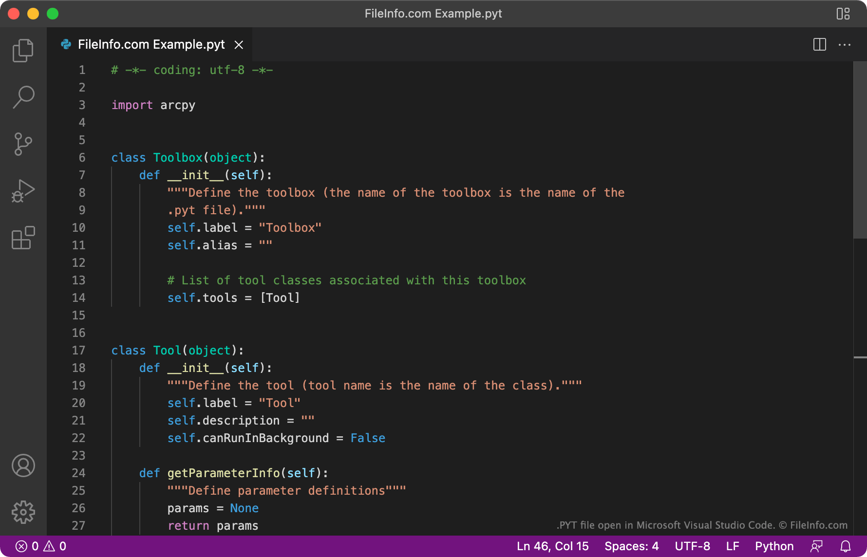
在 Microsoft Visual Studio Code 中打开的 .pyt 文件截图
在 Microsoft Visual Studio Code 中打开的 PYT 文件

ESRI ArcGIS is a mapping and geoanalysis application that allows users to import, edit, annotate, analyze, and otherwise manipulate geographic data. To help them manipulate data, ArcGIS users can access and create toolboxes that contain a collection of related GIS tools. Advanced users can code their own toolboxes and custom tools using the Python programming language. These toolboxes are saved as PYT files.

How to create a PYT file in ArcGIS

To create a new PYT file in ArcGIS:

  1. In the Catalog pane, select Toolboxes.
  2. Select New Python Toolbox.
  3. Name and save your PYT file.

Each PYT file is created from the same template, which uses the Toolbox and Tool classes to define the toolbox's name and included tools. Users can add any number of tools to their PYT file, by adding additional instances of the Tool class.

如何打开 PYT 文件

You can open and edit a PYT file in any text or source code editor. Source code editors, such as Microsoft Visual Studio Code, GitHub Atom, and JetBrains PyCharm, contain helpful syntax-highlighting and code-editing tools that make reviewing and editing PYT files easier.

To import a PYT file into ESRI ArcGIS, create a new Python toolbox in ArcGIS (using the instructions above). Then, copy your PYT file's content into your new Python toolbox and save that toolbox.

使用File Viewer Plus打开 400 多种文件格式。免费下载

可打开 PYT 文件的程序

分类: GIS
更新时间: 2022-03-24

验证者 FileInfo.com

FileInfo.com 团队 独立研究了本页面列出的 Python Toolbox 文件格式和 Mac, Windows, and Linux 应用。 我们的目标是达到 100% 的准确率,并且仅发布我们已验证过的文件类型信息。

如果您想为此页面提出新增或更新建议,请告诉我们