

.PYT 파일 확장자
Python 도구 상자
| 개발사 | ESRI |
| 인기도 |
3.5 | 2 표 |
PYT 파일이란 무엇인가요?
PYT 파일은 ESRI ArcGIS에서 만든 Python 도구 상자입니다. Python 코드로 작성된 지오프로세싱 도구가 포함되어 있습니다. 지리 분석가와 다른 ArcGIS 사용자는 ArcGIS에서 지도 및 기타 데이터를 검토하면서 GIS 작업을 수행하기 위해 PYT 파일을 사용합니다.
추가 정보
ESRI ArcGIS는 사용자가 지리 데이터를 가져오고, 편집하고, 주석을 추가하고, 분석하고, 그 밖의 방식으로 조작할 수 있는 지도 제작 및 지리 분석 애플리케이션입니다. 데이터를 조작하기 위해 ArcGIS 사용자는 관련 GIS 도구 모음이 포함된 도구 상자에 액세스하고 만들 수 있습니다. 고급 사용자는 Python 프로그래밍 언어를 사용하여 자체 도구 상자와 사용자 지정 도구를 코딩할 수 있습니다. 이러한 도구 상자는 PYT 파일로 저장됩니다.
ArcGIS에서 PYT 파일을 만드는 방법
ArcGIS에서 새 PYT 파일을 만들려면 다음 단계를 따르세요.
- 카탈로그 창에서 를 선택합니다.
- 를 선택합니다.
- PYT 파일의 이름을 지정하고 저장합니다.
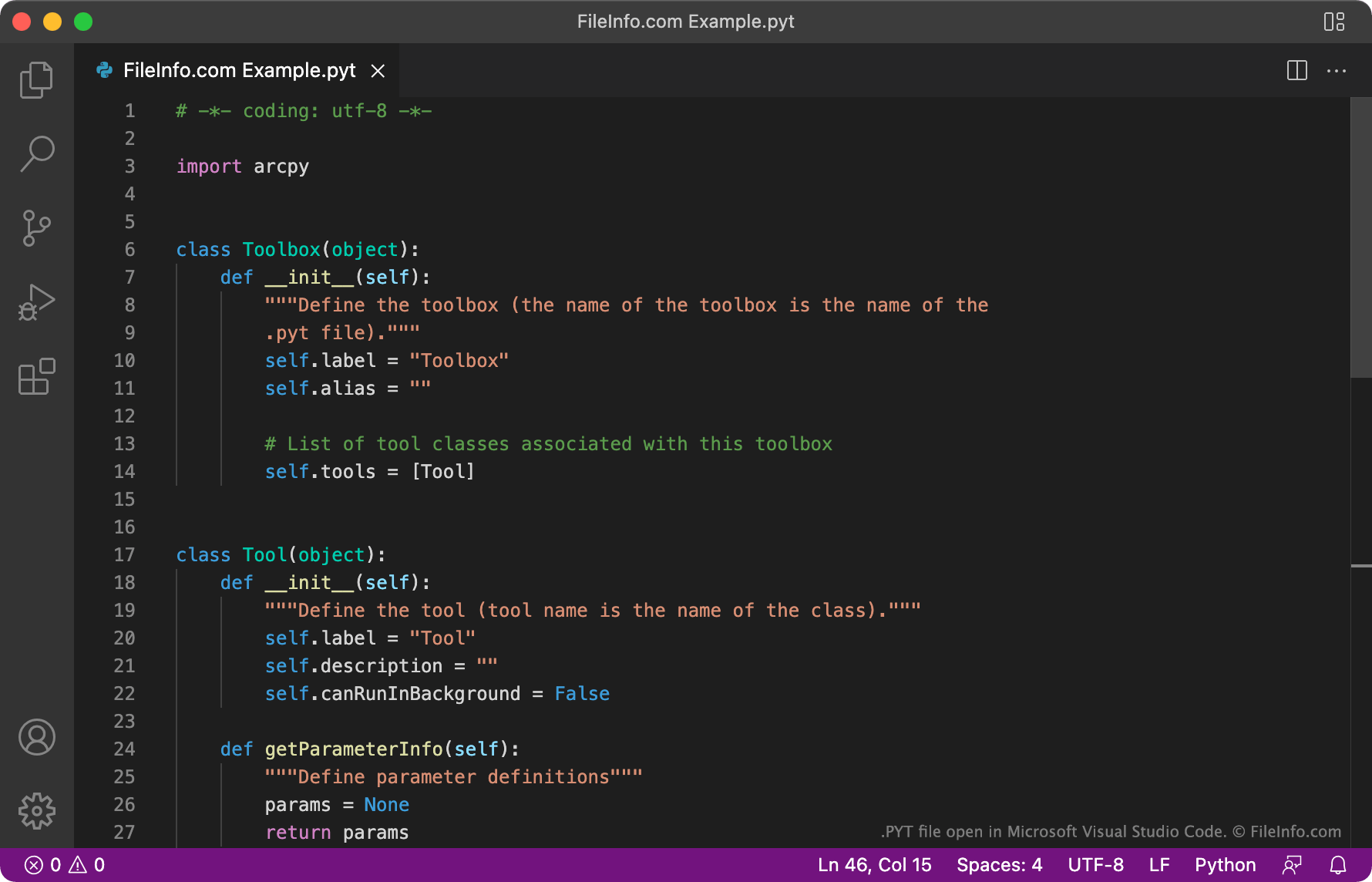
각 PYT 파일은 동일한 템플릿에서 만들어지며, 이 템플릿은 Toolbox 및 Tool 클래스를 사용하여 도구 상자의 이름과 포함된 도구를 정의합니다. 사용자는 Tool 클래스의 인스턴스를 추가하여 PYT 파일에 원하는 수의 도구를 추가할 수 있습니다.
PYT 파일을 여는 방법
PYT 파일은 텍스트 편집기나 소스 코드 편집기에서 열고 편집할 수 있습니다. Microsoft Visual Studio Code, GitHub Atom, JetBrains PyCharm과 같은 소스 코드 편집기에는 유용한 구문 강조 및 코드 편집 도구가 포함되어 있어 PYT 파일을 더 쉽게 검토하고 편집할 수 있습니다.
PYT 파일을 ESRI ArcGIS로 가져오려면 ArcGIS에서 새 Python 도구 상자를 만드세요(위의 지침 사용). 그런 다음 PYT 파일의 내용을 새 Python 도구 상자에 복사하고 해당 도구 상자를 저장합니다.